You have 2 new alerts
 Translate
Springs Specific Plan
Latest News
The Springs Specific Plan is currently going through the environmental review process consistent with the California Environmental Quality Act. A Draft Environmental Impact Report (DEIR) was circulated for public comment from May 18 to July 19, 2022. Copies of the DEIR and Draft Plan can be downloaded from the Project Documents. The DEIR is now being updated to incorporate new information and expand analysis regarding wildfire evacuation, wastewater, and other select topic areas. It is anticipated that updated sections of the DEIR will be recirculated for public review and comment in Fall of 2024.
For More information about the environmental review process: Environmental Review
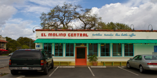
The Springs Specific Plan is a long-term plan to re-imagine the Hwy 12 corridor as a diverse public space with a community plaza and safety improvements for people walking and biking. The project provides increased opportunities for housing, along with additional recreational, commercial and office space to serve the Springs community.
The Springs Specific Plan is based around community-centered objectives that resulted from over 20 public meetings and outreach events held from 2016 to 2019. These objectives include:
 Recognize and promote the Springs commercial corridor as a mixed-use “downtown” serving the larger springs community.
- Develop a centrally-located community plaza.
- Celebrate the unique, multi-cultural identity of the springs,
- Increase affordable, workforce, and mixed use housing,
- Improve the pedestrian, bicycle, and transit network,
- Ensure an adequate parking supply,
- Address community safety, and
- Create and connect to more parks and open space.
In 2015, Sonoma County began a community-driven land-use planning process for this portion of the Sonoma Valley. Located immediately north of the City of Sonoma, the Springs Plan Area includes parts of the unincorporated communities of Aqua Caliente, Fetters Hot Springs, and Boyes Hot Springs. Covering approximately 178 acres, the plan area is bounded by Aqua Caliente Road at the north and Verano Avenue at the south and is bisected by the Highway 12 commercial corridor.
Like the Springs Redevelopment Plan that preceded it, the Specific Plan would support the community’s vision of the Highway 12 corridor as a community-oriented “main street.” New zoning would support a mix of residential and neighborhood oriented commercial uses, with opportunities for more than 700 housing units. The plan would improve community safety by supporting continued improvements to sidewalks, bike lanes and crosswalks for safer and more convenient walking, bicycling and public transit. A community plaza location was identified in response to broad public interest in improved public gathering spaces, and the Plan identifies locations for better connections with local parks. The Plan would also support the community’s vibrant design and diverse character through the introduction of new design guidelines.
What is a Specific Plan?
A Specific Plan is a comprehensive planning and zoning document for a defined area of the County. Specific Plans implement the General Plan with zoning and development standards that are tailored to regulating land use in a specific area. Plans also analyze what infrastructure is necessary and propose financing mechanisms. The environmental review document prepared for a Specific Plan – an Environmental Impact Report in this case – provides an opportunity to holistically address potential impacts on the environment and to change aspects of the plan to provide the best guidance for future development possible.