You have 2 new alerts
 Translate
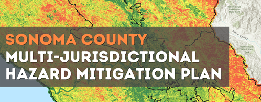
Multi-Jurisdictional Hazard Mitigation Plan
Notice:
The Sonoma County Community Wildfire Protection Plan (CWPP) 2023 Update was signed by the Sonoma County Board of Supervisors on May 9, 2023. The CWPP Update reflects collaborative development with active public participation, identifies wildfire risks and mitigation measures across the County, and lists community-driven Risk Reduction Priorities and specific project recommendations that agencies and community groups can use to develop projects. Multi-Jurisdictional Hazard Mitigation Plan (MJHMP) recommendations are referenced in the CWPP, and the CWPP has been incorporated by reference in the Sonoma County Annex of the MJHMP. Connecting the CWPP and MJHMP helps these plans work together to achieve the goal of reducing risk exposure.
Sonoma County Hazard Mitigation Plan Update
A Hazard Mitigation Plan identifies potential hazards that a planning area is most vulnerable to, assesses risk to populations, property, and critical facilities, and includes a mitigation strategy to reduce risks. The existing 2016 Sonoma County Hazard Mitigation (HMP) was prepared for the County only. The planning process for updating the 2016 HMP leveraged a regional approach to prepare a Multi-Jurisdictional Hazard Mitigation Plan (MJHMP) that comprises the hazard profiles, risk assessments, and mitigation strategies for multiple jurisdictions.
The following jurisdictions participated in the process:
- City of Santa Rosa
- City of Cotati
- Town of Windsor
- City of Sonoma
- County of Sonoma
- Sonoma County Ag + Open Space
- Sonoma Resource Conservation District
- Gold Ridge Resource Conservation District
- Timber Cove Fire Protection District
- Northern Sonoma County Fire Protection District
- North Sonoma Coast Fire Protection District
- Cloverdale Fire Protection District
- Sonoma Valley Fire District
- Rancho Adobe Fire Protection District
The planning process involved significant coordination and collaboration between the planning partners and with the community. Permit Sonoma, in partnership with the Department of Emergency Management, led this effort. A Steering Committee made up of representatives from participating jurisdictions, stakeholders who represent an interdisciplinary group of experts in emergency management, as well as community members oversaw the plan development. The Steering Committee met monthly throughout the planning process and all meetings were open to the public. View copies of meeting materials.
The MJHMP addresses the following hazards:
- Dam Failure
- Drought
- Earthquake
- Flooding
- Landslide/mass movement
- Sea level rise
- Severe weather
- Tsunami
- Wildfire
Purpose of the Hazard Mitigation Plan
The MJHMP assesses hazard vulnerabilities and identifies potential mitigation actions each jurisdiction will pursue in order to reduce the level of injury, property damage, and community disruption that might otherwise result from such events. Adoption of the MJHMP will allow the County and participating jurisdictions to remain eligible for various types of pre- and post-disaster financial assistance from the Federal Emergency Management Agency (FEMA) and the State government.
The MJHMP will integrate into the Public Safety Element of the Sonoma County General Plan 2020 and will serve multiple purposes, including:
- Enhancing public awareness and understanding of the hazards that threaten public health, safety and welfare
- Creating a decision tool for County leaders to take action to address vulnerabilities to future disasters
- Promote compliance with State and Federal program requirements to ensure that Sonoma County and its incorporated cities and towns can take full advantage of state and federal disaster and mitigation grant programs
- Provide inter-jurisdictional coordination of mitigation-related programming
Background
Hazard mitigation is defined as any action taken to reduce or alleviate the loss of life, personal injury, and property damage that can result from a disaster. It involves long- and short-term actions often implemented before disasters, but also during and after. Hazard mitigation activities can include planning efforts, policy changes, programs, studies, improvement projects, and other steps to reduce the impacts of hazards.
The federal Disaster Management Act of 2000 requires state and local governments to develop, and regularly update, hazard mitigation plans (HMPs) as a condition for federal disaster grant assistance. Plans are required to be updated every five years.
In 2006, the Board adopted the first Sonoma County Hazard Mitigation Plan. Permit Sonoma's Comprehensive Planning Section and Fire Prevention Division have worked together to prepare the mandatory 5-year updates. The 2016 Sonoma County Hazard Mitigation Plan Update was adopted on April 25, 2017.
In 2019, Permit Sonoma applied for and received funding from the Federal Emergency Management Agency’s (FEMA) Hazard Mitigation Grant Program to prepare the required update to the 2016 Sonoma County Hazard Mitigation Plan.
The 2021 MJHMP effort began in June 2020 and was led by Permit Sonoma, with support from the Department of Emergency Management, and in partnership with each participating jurisdiction.
Story Map

The MJHMP story map outlines the plan development process and maps Sonoma County’s hazard exposure. The story map also includes an exposure dashboard that provides the results of the exposure assessment conducted for each hazard scenario identified for the Sonoma County Multi-Jurisdictional Hazard Mitigation Plan 2021 update. Check out the MJHMP story map.
Documents
Steering Committee Ground Rules »
Adopted 2021 Sonoma County Multi-Jurisdictional Hazard Mitigation Plan – Volume 1 » (PDF: 23.5 MB)
Adopted 2021 Sonoma County Multi-Jurisdictional Hazard Mitigation Plan – Volume 2 » (PDF: 17.4 MB)
Volume 1 (Area Wide Elements) » (PDF: 23.5 MB)
- Table of Contents » (PDF: 751 kB)
- Executive Summary » (PDF: 922 kB)
- Part 1 – The Planning Process » (PDF: 3.5 MB)
- Part 2 – Risk Assessment » (PDF: 14.6 MB)
- Part 3 – Mitigation Strategy » (PDF: 936 kB)
- References » (PDF: 673 kB)
- Appendix A. Public Involvement Materials » (PDF: 1.2 MB)
- Appendix B. Summary of Federal and State Agencies, Programs and Regulations » (PDF: 900 kB)
- Appendix C. Mapping Methods and Data Sources » (PDF: 621 kB)
- Appendix D. Risk Assessment Results » (PDF: 1.3 MB)
- Appendix E. Peak Riverine Discharges in the Planning Area » (PDF: 852 kB)
- Appendix F. FEMA Approval and Planning Partner Adoption Resolutions » (PDF: 2.6 MB)
- Appendix G. Progress Report Template » (PDF: 864 kB)
Volume 2 (Planning Partner Annexes) » (PDF: 18.1 MB)
- Table of Contents » (PDF: 60 kB)
- Introduction » (PDF: 608 kB)
- Annexes
- County of Sonoma » (PDF: 906 kB)
- City of Cotati » (PDF: 2.7 MB)
- City of Santa Rosa » (PDF: 4.8 MB)
- City of Sonoma » (PDF: 3.2 MB)
- Town of Windsor » (PDF: 3.4 MB)
- Cloverdale Fire Protection District » (PDF: 182 kB)
- North Sonoma Coast Fire Protection District » (PDF: 477 kB)
- Northern Sonoma County Fire Protection District » (PDF: 130 kB)
- Rancho Adobe Fire Protection District » (PDF: 265 kB)
- Sonoma Valley Fire District » (PDF: 553 kB)
- Timber Cove Fire Protection District » (PDF: 1.3 MB)
- Gold Ridge Resource Conservation District » (PDF: 219 kB)
- Sonoma Resource Conservation District » (PDF: 215 kB)
- Sonoma County Agricultural Preservation and Open Space District » (PDF: 298 kB)
- Appendix A. Planning Partner Expectations » (PDF: 156 kB)
- Appendix B. Procedures for Linking to Hazard Mitigation Plan » (PDF: 57 kB)
- Appendix C. Annex Instructions and Templates » (PDF: 3.7 MB)